

Reduction to the Pole#
This function reduces a magnetic dataset to the pole. This shifts the magnetic anomaly directly over the source resulting in a symmetric anomaly shape that is simple to interpret. However, it is only effective if the source body is not remanently magnetised.
The parameters on the interfaced are:
Band to Reduce to the Pole - The band name is directly extracted from the raster file. In the case of a multiband raster dataset the user can specify which band contains the magnetic data that must be processed.
Inclination of the Magnetic Field - Magnetic inclination at the date of the survey.
Declination of the Magnetic Field - Magnetic declination at the date of the survey.
Amplitude Correction Inclination for low latitudes - Pseudo inclination used to correct the amplitude of the RTP filter near the equator (Macleod et al, 1993). Only used if the magnitude of the actual inclination is less than the magnitude of this pseudo inclination.
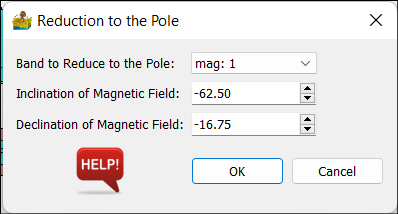
Reduction to the Pole interface.#
The resulting dataset can be exported by right-clicking on the function and selecting Export Raster.
References#
Macleod, I.N., Jones, K., Dai, T.F., 1993. 3-D analytic signal in the interpretation of total magnetic field data at low magnetic latitudes. Exploration Geophysics 24, 679-688.