

Display/Edit Metadata#
This module allows for the display and custom editing of metadata associated with raster images. It is especially useful for defining nodata values or band names.
Band Name - Shows the current name of a raster band within the dataset. Change to a different band by using the drop-down menu.
Rename Band Name allows the user to change the name of the currently selected band.
The Dataset section shows physical information about the dataset.
Top Left X-Coordinate: Raster X coordinate in the NW corner of the dataset.
Top Left Y-Coordinate: Raster Y coordinate in the NW corner of the dataset.
X-Dimension: width of a grid cell (in the x-direction).
Y-Dimension: height of a grid cell (in the y-direction).
Null/Nodata Value: A unique value assigned to areas of the dataset with no data.
Rows: Number of rows in the dataset.
Columns: Number of columns in the dataset.
Dataset minimum: Minimum Z value in the dataset.
Dataset maximum: Maximum Z value in the dataset.
Dataset mean: Mean Z value in the dataset.
Dataset units: A label used in graphs to denote the units of the data in the currently selected band.
Data type: The data type such as float32, float64, integer etc.
Acquisition Date: Data collection date of the currently selected band
Input Projection: Current projection assigned to the raster band. It can be reassigned, but note that this does not reproject the data.
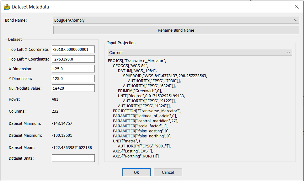
Display/Edit Metadata interface.#